


Area: 6,348.3 sq. km
Population: 1,684.6 thousand habitants (2006)
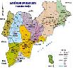
Capital: Rach Gia City
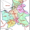
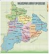
Administrative divisions:
- Town: Ha Tien.
- Districts: Kien Luong, Hon Dat, Tan Hiep, Chau Thanh, Giong Rieng, Go Quao, An Bien, An Minh, Vinh Thuan, Phu Quoc, Kien Hai, U Minh Thuong.
Kien Giang province official website
Geography
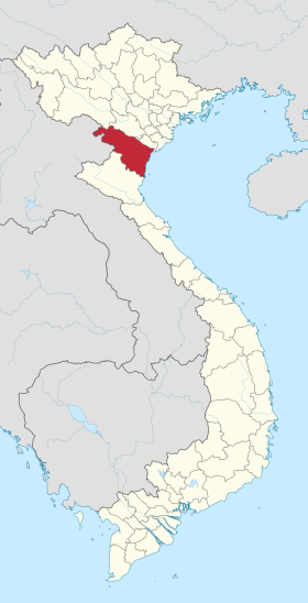
Kien Giang is on the Mekong Delta. It is bounded by An Giang, Hau Giang provinces, Can Tho City in the east and the south - east, Ca Mau Province in the south, and Cambodia in the north.
Kien Giang has 200km of coastline with large fishing grounds, consisting of 105 big and small islands, of which 43 islands have residents. This creates favorable conditions and good environment for raising many sorts of aquaculture.
Climate: Kien Giang locates on humid monsoon tropical area. The weather is always warm with few natural calamities and abundant of sunshine. The average temperature is 27ºC. It is highest in April (29ºC) and lowest in January (25.6ºC). There are two separated seasons: the rainy season is from April to November, the dry season is from December to April.
The 2018 Kien Giang Province investment promotion forum held in Jan was seen as an affirmative undertaking to establish the province’s potential, economic strengths and call for investment.
Northern Key Economic Zone
-
 Ha Noi Capital
14 industrial parks -
 Vinh Phuc Province
6 industrial parks -
 Quang Ninh Province
4 industrial parks -
 Bac Ninh Province
15 industrial parks -
 Hai Phong City
5 industrial parks -
 Hung Yen Province
5 industrial parks -
 Hai Duong Province
11 industrial parks -
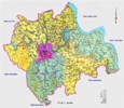 Hà Nam
2 industrial parks -
 Bac Giang
1 industrial parks -
 Nam Định
2 industrial parks
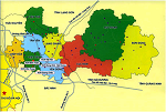
Central Key Economic Zone
-
 Da Nang City
6 industrial parks -
 Thua Thien Hue Province
4 industrial parks -
 Khanh Hoa Province
5 industrial parks -
 Quang Ngai Province
6 industrial parks -
 Quang Nam Province
9 industrial parks -
 Binh Dinh Province
7 industrial parks -
 Phu Yen Province
4 industrial parks -
 Gia Lai
1 industrial parks -
 ĐĂK NÔNG
1 industrial parks -
 ĐĂK LĂK
1 industrial parks -
 KON TUM
0 industrial parks -
 Thanh Hoá
1 industrial parks
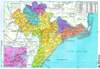
Southern Key Economic Zone
-
 Binh Thuan Province
6 industrial parks -
 Ho Chi Minh City
22 industrial parks -
 Dong Nai Province
31 industrial parks -
 Binh Duong Province
28 industrial parks -
 Long An
36 industrial parks -
 Ba Ria-Vung Tau Province
11 industrial parks -
 Tay Ninh Province
4 industrial parks -
 Tien Giang Province
5 industrial parks -
Binh Phuoc Province
7 industrial parks
