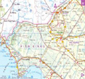
The geographical location is quite special: in spite of located in the Mekong Delta region, Long An province belongs to Southern Key Economic Zone.
- Having boundary with Cambodia: 137.7 km, two gates Binh Hiep (Moc Hoa) and Tho Mo (Duc Hue).
- As the gateway linking the South East with the Mekong Delta, especially shares boundaries with TP. Ho Chi Minh City by road transport systems such as: the National Highway 1A and Highway 50. . . the provincial road: DT.823, DT.824, DT.825 . . .
- Regional and national waterway has been upgraded, expanded, new construction, new dynamics and opportunities for development.
- In addition, Long An also enjoys water of the two systems Mekong and Dong Nai.
The location is nearby Ho Chi Minh City and increasingly relationship with Southern Key Economic Zone. In recent years, Long An has provided 50% of the country's industrial output and is the investment partners, technology transfer, also is the largest agricultural commodity markets of the Mekong Delta.
.jpg)
Department of Planning and Investment
Address: 61 Truong Dinh, Ward 1, Tan An town, Long An province.
Director: Nguyen Minh Ha
Phone: (072). 3823461 - 3837383
Website: http://skhdt.longan.gov.vn.
Department of Natural Resources - Environment
Address: 137 Highway 1A - Tan An town, Long An province.
Director: Nguyen Van Be
Phone: (072) 3826260
Fax: (072) 3823264
Website: http://tnmt.longan.gov.vn.
Management of IP
Address: 65B - Chau Van Giac - Ward 2 -Tan An - Long An.
Chairman: Phan Thanh Phi
Phone: (072) 3 825 446
Fax: (072) 3 825 442
Email: [email protected]
Website: http://bqlckcn.longan.gov.vn.
People's Committee of Long An Province
Address: 61 Nguyen Hue Street, Ward 1, Tan An City, Long An
Email: [email protected]
Phone: (072) 3 823 810
Website: http://www.longan.gov.vn/
Area:
Nature: 4491.221 km2 (accounting for 1.3% of the country and by 8.74% of the area of the Mekong Delta.)
Population:
Population: 1,448,000 (as of 2010).
Labor force: 976,000 (2010)
Climate:
- Long An Province is located in the characterized tropical climate by equatorial monsoon -> rich humid heat, abundant sunshine, long time radiation, amplitude of diurnal temperature between the months is low, moderate.
- Average temperature: 27.2 -27.7 oC.
Terrain:
- Topography of Long An is divided by interlaced rivers and canals system with a total length of up to 8912 km, Vam Co Dong river and Vam Co Tay river is combined to Vam Co river, ... the largest of which is the Vam Co Dong River flows through Long An.
- Along the border in Long An, which has five gates, including:
My Qui Tay gate - Duc Hue
Binh Hiep (Pray-Vo) gate - Moc Hoa
Vam Don gate - Vinh Hung
Channel 28 gate - Vinh Hung
My Quy Tay (Xom-Rong).
- In addition, there are five points of exchange of goods, such as Voi Dinh, Soc Rinh (Duc Hue), Ta Lot ( Moc Hoa), Rach Chanh, Tau Nu, Cay Tram Do (Vinh Hung).
Long An is the gateway linking the South East with the Mekong Delta, a common boundary with the Ho Chi Minh City. The linking provincial transportation systems are quite complete, including roads and waterways.
Road Traffic:
• The National Highway: National Highway 1A, Highway 62, Highway 50, Highway N1, N2 routes, the Ho Chi Minh highway in Ho Chi Minh City - Trung Luong.
• The provincial roads: Provincial Highway 7, Provincial Highway 8, Provincial Highway 22, Highway 821, Provincial Highway 822, Provincial Highway 823, Provincial Highway 824, Provincial Highway 825, Provincial Highway 826, Provincial Highway 827, Provincial Highway 828, provincial Highway 829, provincial Highway 831, provincial Highway 833, provincial Highway 835, provincial Highway 836, provincial Highway 837, provincial Road 838 and provincial road 839.
Waterway:
• The waterway routes: Vam Co Dong and Vam Co Tay rivers, Rach Cat river (Can Giuoc river).
• The important waterways: Ho Chi Minh City - Kien Luong; Ho Chi Minh City - Ca Mau; Ho Chi Minh City - Tay Ninh and Long An is via Nuoc Man canal, Rach Cat river, Vam Co Dong river.
The water transports above 100 tons could follow the canal as Phuoc Xuyen, Duong Van Duong, Tra Cu, Kinh Xang, Ben Luc river, Rach Cat river, Thu Thua canal ... from the West to the Ho Chi Minh City.
* Strategic location:
Long An to Tan Son Nhat airport about 1 hour by car, has 4 highway, 2 freeway through the province,has Binh Hiep international border, My Phu Tay national gate and 3 side-gate , port capable of receiving vessels of 70,000 DWT in the Soai Rap and many river port for 6000-10000 DWT. Currently Long An has 23 industrial parks and 43 industrial and 50 residential urban areas over 15,000 ha.
Gross domestic product in province (GDP) growth of 9.9% (previous year 11.7%)
• Region I (agriculture, forestry and fisheries) increased by 3.3%, contributing 1.2 percentage points.
• Region II (industry and construction) increased by 14.9%, contributing 5.8 percentage points.
• Region III (trade and services) increased by 11.4%, contributing 2.9 percentage points.
(According to data the first 9 months of 2012 and forecasts of the Bureau of Statistics of Long An province).
The province has 35 industrial parks with a total area over 10,940.7 hectares, of which 22 were in operation with a total the area over 5.753ha. In addition, the province has 40 industrial parks with a total planning area of 4428.24 ha, of which 9 industrial went into operation, a total area of 723.73 hectares.
Extensive experience in administrative reform, especially simple administrative procedures, improve competitiveness.
In recent years, Long An province is always in the top 10 on the index of competition and foreign investment (FDI).
Some projects are implemented:
• Project the Ben Luc - Long Thanh passed through Long An.
• Project Nam Long-Vam Co Dong wide 355ha in Ben Luc District (Long An).
• Project Five Star by Five Star International Group investment.
• Project Happy Land (Vietnam complex entertainment) by Khang Thong Group investment.
Northern Key Economic Zone
-
 Ha Noi Capital
14 industrial parks -
 Vinh Phuc Province
6 industrial parks -
 Quang Ninh Province
4 industrial parks -
 Bac Ninh Province
15 industrial parks -
 Hai Phong City
5 industrial parks -
 Hung Yen Province
5 industrial parks -
 Hai Duong Province
11 industrial parks -
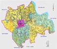 Hà Nam
2 industrial parks -
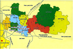 Bac Giang
1 industrial parks -
 Nam Định
2 industrial parks
Central Key Economic Zone
-
 Da Nang City
6 industrial parks -
 Thua Thien Hue Province
4 industrial parks -
 Khanh Hoa Province
5 industrial parks -
 Quang Ngai Province
6 industrial parks -
 Quang Nam Province
9 industrial parks -
 Binh Dinh Province
7 industrial parks -
 Phu Yen Province
4 industrial parks -
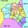 Gia Lai
1 industrial parks -
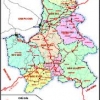 ĐĂK NÔNG
1 industrial parks -
 ĐĂK LĂK
1 industrial parks -
KON TUM
0 industrial parks -
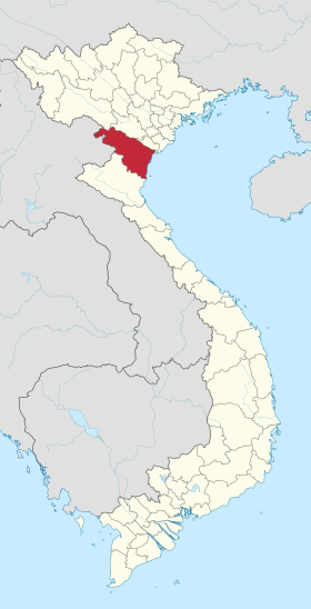 Thanh Hoá
1 industrial parks
Southern Key Economic Zone
-
 Binh Thuan Province
6 industrial parks -
 Ho Chi Minh City
22 industrial parks -
 Dong Nai Province
31 industrial parks -
 Binh Duong Province
28 industrial parks -
 Ba Ria-Vung Tau Province
11 industrial parks -
 Tay Ninh Province
4 industrial parks -
 Tien Giang Province
5 industrial parks -
 Binh Phuoc Province
7 industrial parks
Mekong Delta
-
 AN GIANG
5 industrial parks -
BẠC LIÊU
5 industrial parks -
 BẾN TRE
2 industrial parks -
 CÀ MAU
4 industrial parks -
 Vĩnh Long
4 industrial parks -
 Đồng Tháp
3 industrial parks -
Trà Vinh
1 industrial parks -
 Cần Thơ
10 industrial parks -
 Sóc Trăng
4 industrial parks -
 Hậu Giang
3 industrial parks -
 Kiên Giang
6 industrial parks


 Introduction