

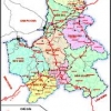
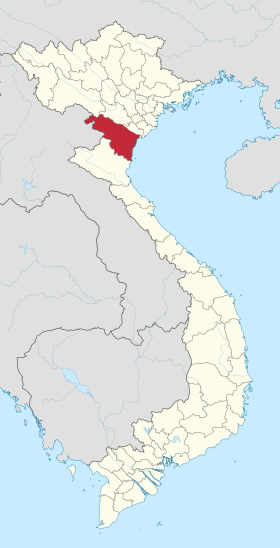
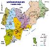
 Overview
.jpg)
|
|
2001
|
2002
|
2003
|
2004
|
2005
|
|
Average Population (1000 người)
|
5.285
|
5.449
|
5.630
|
6.117
|
6.240
|
|
Male
|
2.546
|
2.625
|
2.713
|
2.920
|
2.996
|
|
Female
|
2.739
|
2.824
|
2.917
|
3.142
|
3.243
|
|
Urban
|
4.410
|
4.542
|
4.661
|
5.170
|
5.315
|
|
Rural
|
875
|
907
|
969
|
893
|
925
|
|
Natural population growth rate (%)
|
1,30
|
1,27
|
1,15
|
1,20
|
1,15
|
|
Mechanical population growth rate (%)
|
0,77
|
0,90
|
1,2
|
2,1
|
2,0
|
|
Population at working ages (1000)
|
2.267
|
2.336
|
2.503
|
2.586
|
2.676
|
|
Unemployment rate of Urban area(%)
|
6,04
|
6,54
|
6,13
|
6,0
|
|
|
Number of hospitals
|
38
|
38
|
38
|
55
|
56
|
|
local clinic
|
43
|
43
|
43
|
29
|
29
|
* Welcome to website: www.tourism.hochiminhcity.gov.vn
Airway:
Tân Sơn Nhất International Airport
The city is served by Tân Sơn Nhất International Airport, the largest airport in Vietnam in terms of passengers handled (with an estimated number of over 15.5 million passengers per year in 2010, accounting for more than half of Vietnam's air passenger traffic). Long Thành International Airport is scheduled to begin operating in 2025. Based in Long Thành, Đồng Nai Province, about 40 km northeast of Ho Chi Minh City, Long Thành Airport will serve international flights, with a maximum traffic capacity of 100 million passengers per year when fully completed; Tân Sơn Nhất Airport will serve domestic flights.
Railway:
Ho Chi Minh City is also a terminal for many Vietnam Railways train routes in the country. The Reunification Express (tàu Thống Nhất) runs from Ho Chi Minh City to Hanoi from Saigon Railway Station in District 3, with stops at cities and provinces along the line. Inner the city, the two main station are Sóng Thần and Sài Gòn. Besides, there are several small station such as Dĩ An, Thủ Đức, Bình Triệu, Gò Vấp. However, the rail transportation is not developed because it got about 0.6 percent of the number passenger and 6 percent of transporting merchandise.
Waterway:
The city's location on the Saigon River makes it a bustling commercial and passenger port; besides a constant stream of cargo ships, passenger boats operate regularly between Ho Chi Minh City and various destinations in Southern Vietnam and Cambodia, including Vũng Tàu, Cần Thơ and the Mekong Delta, and Phnom Penh. Traffic between Ho Chi Minh City and Vietnam's southern provinces has steadily increased over the years; the Doi and Te Canals, the main routes to the Mekong Delta, receive 100,000 waterway vehicles every year, representing around 13 million tons of cargo. A project to dredge these routes has been approved to facilitate transport, to be implemented in 2011–14.
Coach bus:
Ho Chi Minh City has a number of coach houses, which house coach busses to and from other areas in Vietnam. The largest coach station – in terms of passengers handled – is the Mien Dong Coach Station in the Binh Thanh District.
Department of Planning and Investment
Address: No. 32, Le Thanh Ton, District 1, HCMC.
Phone: (84.8) 38272191
Fax: (84.8) 8295008
Email: [email protected]
Website: http://www.dpi.hochiminhcity.gov.vn/
Department of Natural Resources - Environment
Address: No.63, Ly Tu Trong, District 1, HCMC
Phone: 84-8-8293661
Fax: 84-8-8231806
Email: [email protected]
Website: http://www.donre.hochiminhcity.gov.vn/default.aspx
Management of IP
Address: No.35, Nguyen Binh Khiem, District 1, HCMC
Phone: 84.8-38290414
Fax: 84.8-38294271
Email: [email protected]
Website: http://www.hepza.gov.vn
People's Committee of Ho Chi Minh City
Address: No.86, Le Thanh Ton, District 1, HCMC
Phone: 84.8-38296952
Fax: 84.8-38295026
Email: [email protected]
Northern Key Economic Zone
-
 Ha Noi Capital
14 industrial parks -
 Vinh Phuc Province
6 industrial parks -
 Quang Ninh Province
4 industrial parks -
 Bac Ninh Province
15 industrial parks -
 Hai Phong City
5 industrial parks -
 Hung Yen Province
5 industrial parks -
 Hai Duong Province
11 industrial parks -
 Hà Nam
2 industrial parks -
 Bac Giang
1 industrial parks -
 Nam Định
2 industrial parks
Central Key Economic Zone
-
 Da Nang City
6 industrial parks -
 Thua Thien Hue Province
4 industrial parks -
 Khanh Hoa Province
5 industrial parks -
 Quang Ngai Province
6 industrial parks -
 Quang Nam Province
9 industrial parks -
 Binh Dinh Province
7 industrial parks -
 Phu Yen Province
4 industrial parks -
 Gia Lai
1 industrial parks -
 ĐĂK NÔNG
1 industrial parks -
 ĐĂK LĂK
1 industrial parks -
 KON TUM
0 industrial parks -
 Thanh Hoá
1 industrial parks
Southern Key Economic Zone
-
 Binh Thuan Province
6 industrial parks -
 Dong Nai Province
31 industrial parks -
 Binh Duong Province
28 industrial parks -
 Long An
36 industrial parks -
 Ba Ria-Vung Tau Province
11 industrial parks -
 Tay Ninh Province
4 industrial parks -
 Tien Giang Province
5 industrial parks -
Binh Phuoc Province
7 industrial parks
Mekong Delta
-
 AN GIANG
5 industrial parks -
 BẠC LIÊU
5 industrial parks -
 BẾN TRE
2 industrial parks -
 CÀ MAU
4 industrial parks -
 Vĩnh Long
4 industrial parks -
 Đồng Tháp
3 industrial parks -
 Trà Vinh
1 industrial parks -
 Cần Thơ
10 industrial parks -
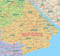 Sóc Trăng
4 industrial parks -
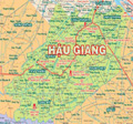 Hậu Giang
3 industrial parks -
 Kiên Giang
6 industrial parks
