


 Overview
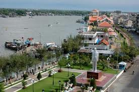
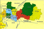
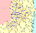
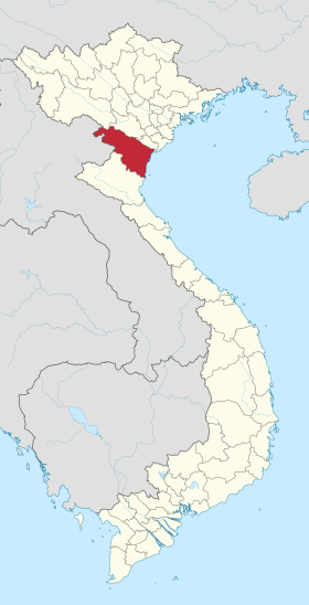
Can Tho City is located in the central-lower basin and at the centre of Mekong River Delta Region,lengthened in 55km along Western Bank of Hau River with total area of 1,401.60km2, accounting for 3.49% of total area of the region.
Geographical location:
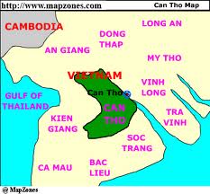
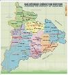
Adjacent to the provinces:
- An Giang province in the North
- Hau GIang in the South
- Dong Thap province in the East
- Kien Giang province in the West.
Area:
1.401,61 km²
Population:
The average population: 1.200.300 people (2011)
Climate:
Can Tho City has two seasons of rain and dry seasons.
The rain season lasts from May to September.
From December to April the following year is the dry season.
The average temperature: 27 º C.
Terrain:
Geography, topography and geology of the city includes 3 forms: Natural dike along Hau River, semi-open flooding fields and river delta fields. The common altitude is from +0.8 – 1m, lower from the East-North to West-South. The region is mainly formed from the accumulation of sea deposit and alluvium from Mekong River.
Roads:
The whole city has 2,762.84km of road with the density of 2.3km/km2 (exchiding commune, hamlet roads, the whole city has 698.548km of road with the density of 0.5km/km2).
Waterway:
The network of waterway systen in the city has total length of 1,157km, in which approximately 619km with enough capacity for means of transportation with capacity of from 30 tons or higher (normal depth is >2.5m).
The system of ports of Can Tho were upgradeed including CanTho Port (Hoang Dieu Port) which can receive vessels with the capacity of 10,000 to 20,000 DWT; Tra Noc Port with 3 big stores with capacity of 40,000 tons which can ensure the clearance of 200,000 tons of goods per year and can receive vessels with capacity of 2,500 DWT. Cai Cui Port is a newly constructed port which can serve vessels with capacity of from 10,000 to 20,000 DWT, and the capacity for clearing 4.2 million tons off goods through the port per year.
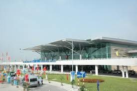
Air:
Can Tho airport is the biggest airport in the Mekong River Delta region which has been officially operated for commercial exploitation of dsomestic flights since 03/01/2009 and international flights shall be openned for exploitation at the end of 2010.
Total revenue in 2011 reached 7552.8 billion. Gross domestic product (GDP) of Can Tho city is 32351.5 billion. Average economic growth rate of 5 years was 15.5%, per capita income in 2011 was $ 2,350. Can Tho is the center of economy, culture, education and training, important clues about local transportation and international shipping of the Mekong Delta and the country. In the ranking of provincial competitiveness index of Vietnam in 2011, Can Tho City, ranked at No. 14/63 provinces.

Department of Planning and Investment
Address: 61/ 21 Ly Tu Trong, Ninh Kieu District, Can Tho
Phone: (071) 3830235
Fax: (071) 3830570
Email: [email protected]
Website: http://cantho.gov.vn/wps/portal/sokhdt
Department of Natural Resources - Environment
Address: 09 Cach Mang Thang Tam, Ninh Kieu District,, Can Tho
Phone: 0710.3822751
Fax: 0710.3826838
Email: [email protected]
Website: http://cantho.gov.vn/wps/portal/sotnmt
Management of IP
Address: 105 Tran Hung Dao, Tan Phu Ward, Ninh Kieu District, Can Tho
Phone: (0710) 3830773
Fax: (0710) 3830773
Email: [email protected]
Website: http://bqlkcxcn.cantho.gov.vn
People's Committee of Can Tho
Address: 02 Hoa Binh, Ninh Kieu District, Can Tho
Phone: 080.71165
Fax: 080.71182
Email: [email protected]
Website: http://cantho.gov.vn/wps/portal/vpubndtp
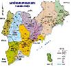
Northern Key Economic Zone
-
 Ha Noi Capital
14 industrial parks -
 Vinh Phuc Province
6 industrial parks -
 Quang Ninh Province
4 industrial parks -
 Bac Ninh Province
15 industrial parks -
 Hai Phong City
5 industrial parks -
 Hung Yen Province
5 industrial parks -
 Hai Duong Province
11 industrial parks -
 Hà Nam
2 industrial parks -
 Bac Giang
1 industrial parks -
 Nam Định
2 industrial parks
Central Key Economic Zone
-
 Da Nang City
6 industrial parks -
 Thua Thien Hue Province
4 industrial parks -
 Khanh Hoa Province
5 industrial parks -
 Quang Ngai Province
6 industrial parks -
 Quang Nam Province
9 industrial parks -
 Binh Dinh Province
7 industrial parks -
 Phu Yen Province
4 industrial parks -
 Gia Lai
1 industrial parks -
 ĐĂK NÔNG
1 industrial parks -
 ĐĂK LĂK
1 industrial parks -
 KON TUM
0 industrial parks -
 Thanh Hoá
1 industrial parks
Southern Key Economic Zone
-
 Binh Thuan Province
6 industrial parks -
 Ho Chi Minh City
22 industrial parks -
 Dong Nai Province
31 industrial parks -
 Binh Duong Province
28 industrial parks -
 Long An
36 industrial parks -
 Ba Ria-Vung Tau Province
11 industrial parks -
 Tay Ninh Province
4 industrial parks -
 Tien Giang Province
5 industrial parks -
Binh Phuoc Province
7 industrial parks
